Building footprints in Phnom Penh
Published by: Open Development Cambodia
Data Resources (7)
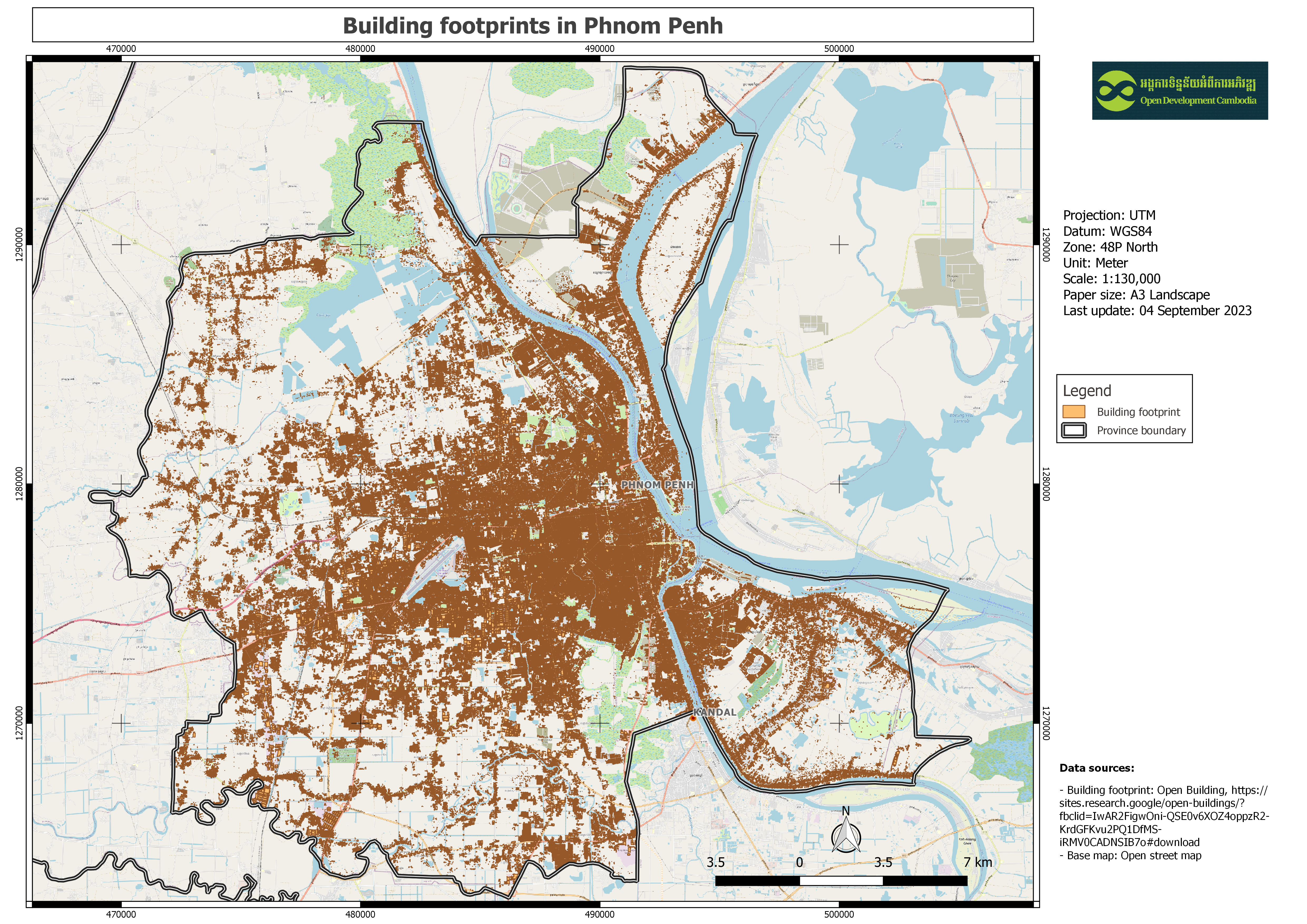
Data Resource Preview - Building footprints in Phnom Penh
Additional Info
| Field | Value |
|---|---|
| Dataset topic category |
|
| Language |
|
| Use limitations | By accessing this website OD Mekong website and database users agree to take full responsibility for reliance on any site information provided and to hold harmless and waive any and all liability against individuals or entities associated with its development, form and content for any loss, harm or damage suffered as a result of its use. |
| Dataset reference date | May 1, 2023 |
| GeoNames |
|
| Spatial Reference System | WGS 84 / UTM zone 48N (EPSG:32648) |
| Positional Accuracy | The accuracy regarding to the Imagery completeness errors and detection error, estimated 80% and 90% precision levels. |
| Attribute Accuracy | There are no known issues with attribute accuracy. |
| Logical Consistency | There are no known issues with logical consistency. |
| Completeness | The dataset freshness is determined by the availability of the high-resolution source imagery which used to detect buildings. |
| Process Step | This dataset contains polygon data in CSV format that was manually downloaded for a single cell in the Cambodia region. Then, using the QGIS application, clip only the Phnom Penh border, export as geospatial data, and upload to the ODC website. |
| Lineage | Òpen Building: https://sites.research.google/open-buildings/?fbclid=IwAR2FigwOni-QSE0v6XOZ4oppzR2-KrdGFKvu2PQ1DfMS-iRMV0CADNSIB7o#download |
| Responsible party | W. Sirko, S. Kashubin, M. Ritter, A. Annkah, Y.S.E. Bouchareb, Y. Dauphin, D. Keysers, M. Neumann, M. Cisse, J.A. Quinn. Continental-scale building detection from high resolution satellite imagery. arXiv:2107.12283, 2021. |
| Metadata creator information | Metadata last updated on 2020-04-09. For inquiries contact: Open Development Cambodia, Email: contact@opendevcam.net, Website: http://www.opendevcam.net Address: 43 St. 208, Phnom Penh, Cambodia |
| Attributes | latitude: latitude of the building polygon centroid; longitude: longitude of the building polygon centroid; area_in_me: area in square meters of the polygon; confidence: confidence score [0.65;1.0] assigned by the model; geometry: the building polygon in the WKT format (POLYGON or MULTIPOLYGON); This feature is present in only in polygons data; full_plusc: the full Plus Code at the building polygon centroid |
| Update Frequency | unknown |
| License | Creative Commons Attribution Share-Alike |
| Copyright | No |
| Version | 3 |
| Province(s) |
|
| Keywords | Building,Footprints |
| Date uploaded | August 31, 2023, 02:12 (UTC) |
| Date modified | October 18, 2023, 07:58 (UTC) |