Well locations in Cambodia (2010)
พิมพ์โดย: Open Development Cambodia
ทรัพยากรข้อมูล (6)
ตัวอย่างทรัพยากรข้อมูล - VIE-Immigrant ethnic minority
ข้อมูลเพิ่มเติม
| ฟิลด์ | ค่า |
|---|---|
| หมวดหมู่หัวข้อของชุดข้อมูล |
|
| ภาษา |
|
| ข้อจำกัดการใช้งาน | By accessing this website or database, users agree to take full responsibility for reliance on any site information provided and to hold harmless and waive any and all liability against individuals or entities associated with its development, form and content for any loss, harm or damage suffered as a result of its use. |
| วันที่ชุดข้อมูล | 1 มีนาคม ค.ศ. 2010 |
| วันที่เริ่มใช้ขอบเขตชั่วคราว | 1 มกราคม ค.ศ. 1930 |
| วันสุดท้ายของขอบเขตชั่วคราว | 12 กรกฎาคม ค.ศ. 2009 |
| ชื่อทางภูมิศาสตร์ |
|
| พิกัดขอบเขตทิศตะวันตก | 102.34907451824131 |
| พิกัดขอบเขตทิศตะวันออก | 107.04827313099291 |
| พิกัดขอบเขตทิศใต้ | 10.419681891200902 |
| พิกัดขอบเขตทิศเหนือ | 14.335476031500656 |
| ระบบอ้างอิงเชิงพื้นที่ | WGS 84 / UTM zone 48N (EPSG:32648) |
| ความแม่นยำเชิงตำแหน่ง | There are no known about the issues of accuracy. |
| ความสอดคล้องเชิงตรรกะ | There are no known about the issues of logical consistency. |
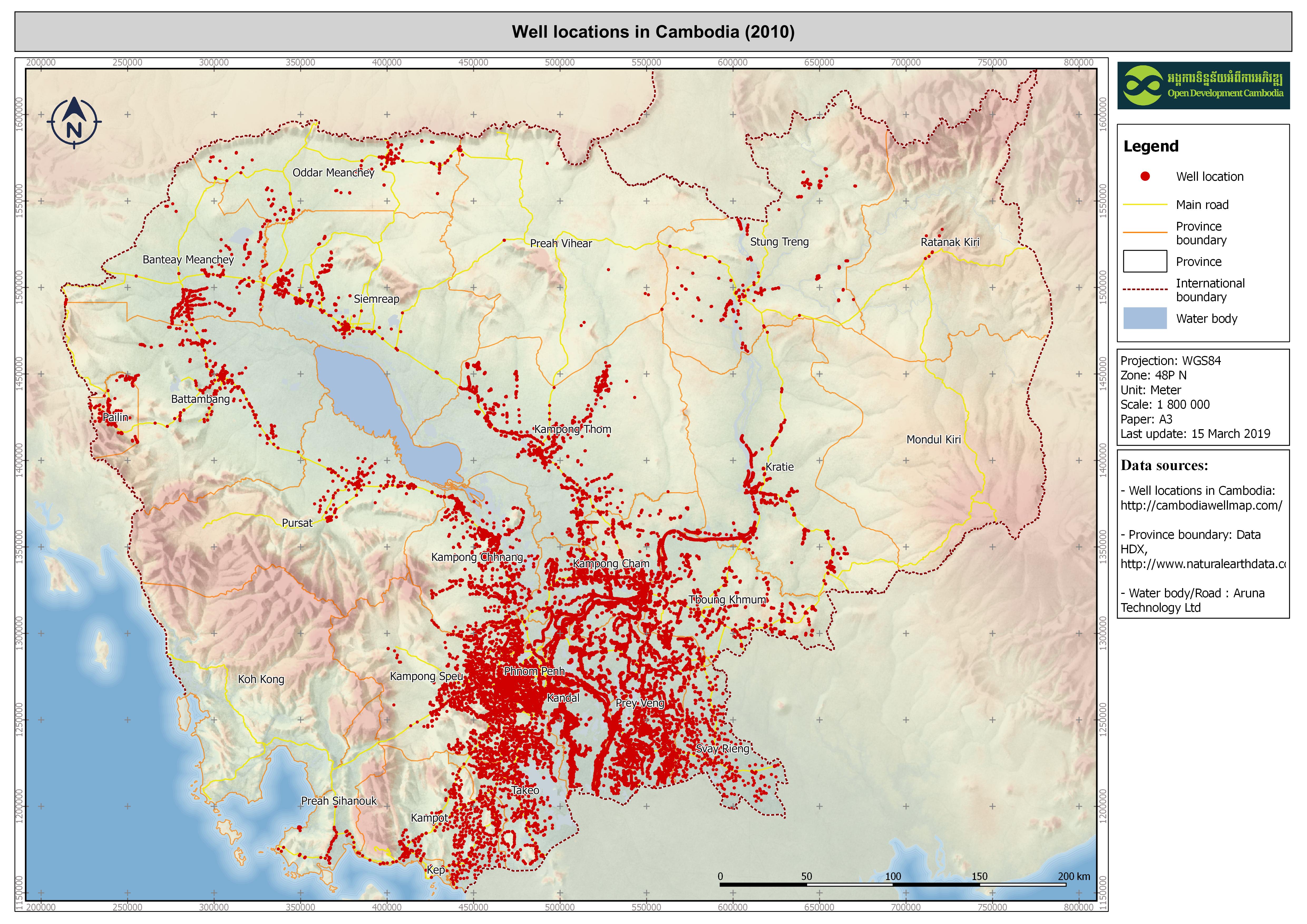
| ความสมบูรณ์ | There are 62060 records in the national well database. Some of well's coordinates were not provided in database. Therefore, ODC mapper could map out only the existing wells that contained coordinates. |
| ขั้นตอนของกระบวนการ | ODC's map and data team collected the dataset in Microsoft Access format from Cambodia WellMap website and then converted it into Shapefile, KML and Geojson formats in order to be re-published, and available for download, on ODC website. The team also used CartoDB to visualize the Wellmap dataset on its Interactive map, which is available via the link: https://opendevelopmentcambodia.net/map-explorer. |
| แหล่งที่มา | Ministry of Rural Development of Cambodia, Tonle Sap Rural Water Supply and Sanitation Sector Project funded by ADB, Water quality database of Resource Development International (RDI), Well database and Arsenic database of UNICEF, , and Well database of World Vision International. |
| ฝ่ายงานรับผิดชอบ | Cambodia WellMap, website: http://cambodiawellmap.com/ |
| ข้อมูลผู้สร้างคำอธิบายชุดข้อมูล | Metadata last updated on 2016-10-20. For inquiries contact: Open Development Cambodia (ODC). Address: #43 St. 208, Phnom Penh, Cambodia. Email: contact@opendevcam.net Website: https://opendevelopmentcambodia.net |
| สัญญาอนุญาต | CC-BY-4.0 |
| ลิขสิทธิ์ | Yes |
| เวอร์ชัน | 1.0 |
| คำสำคัญ | Well,water,sanitation |
| วันที่อัพโหลด | ตุลาคม 21, 2016, 09:27 (UTC) |
| แก้ไขเมื่อ | ตุลาคม 8, 2019, 18:41 (UTC) |